OziExplorer is GPS Mapping Software which runs on your PC or
laptop and will
work with Magellan, Garmin, Lowrance, Eagle,
Silva/Brunton and MLR
GPS receivers for the upload and download of waypoints, routes
and tracks, and most makes
of GPS receivers for on screen tracking of GPS position (moving map).
|
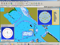
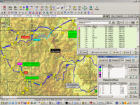
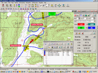
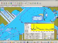
OziExplorer software showing
different
maps and examples of the many additional data windows. |
|
 |
 |
 |
 |
|
Anchor Alarm and Satellite Display |
Waypoint List and Route Editor |
Moving Map and Navigation data |
Track Profile |
|
Overview
 |
Plan Your Trip |
| |
OziExplorer allows you to work, on your computer screen, with
maps that you create from purchased digital maps or maps you have scanned.
By using these maps OziExplorer allows you to plan your trip by creating
waypoints, routes and tracks on screen and upload these to your GPS. Add special
features/symbols and comments to your map.
Also run
OziExplorer on your Windows tablet using your maps and data from
OziExplorer running on your desktop PC. Plan on your PC
and copy your maps and data to your mobile device / in car navigator
running OziExplorerCE (Windows CE O/S) or OziExplorer Android (Android
O/S). |
| |
|
 |
Real Time Tracking (Moving
Map) |
| |
With OziExplorer running and your laptop connected to your GPS, your
GPS position is plotted on the map providing real time tracking ability (moving map).
When you leave a map OziExplorer automatically changes to the next map or
even better, OziExplorer can search out the most detailed map for the area
you are traversing. Use the navigation feature to help you navigate to a
waypoint or along a route.
|
| |
|
 |
Save Your Trip Data |
| |
Waypoints, routes and tracks created or collected by your GPS
during your travels can be downloaded by OziExplorer and viewed on the map.
Using the tools built into OziExplorer these can be
edited and saved to your hard disk for future use. (Save your 4WD
track or the waypoints locating your best fishing spots).
|
| |
|
 |
Navigation |
| |
In moving map mode OziExplorer will navigate you along your chosen route
giving instructions when each waypoint is reached. Various parameters such
as Speed, Course, Next Waypoint, Distance, CTS, XTE, ETE and ETA are
displayed.
|
| |
|
 |
Interface to GIS systems |
| |
Useful for
collecting data in the field for later use in GIS software. Reads and writes Arcview shape files, reads Mapinfo MIF files, reads E00
files.
|
 |
Potential Use |
| |
-
Recreation - boating, 4 wheel driving, flying,
hiking/bushwalking, geocaching
-
Rural Fire Fighting
-
Search and Rescue
-
Route planning and guidance for people working in the
field
|
| |
|
Note : OziExplorer cannot upload maps to any mapping GPS.
These require special maps and software which is usually only provided by
the GPS manufacturer. |


